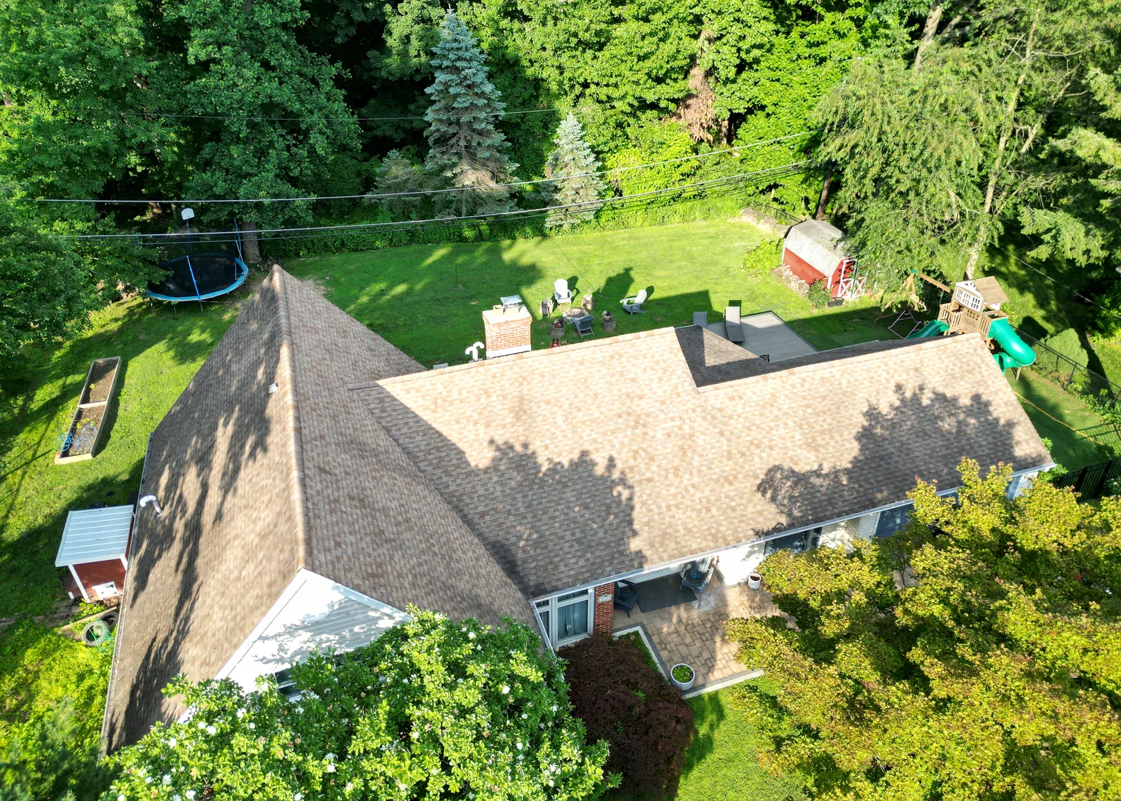
Aerial Listing Photos
The full property from above
- Edited aerial photos
- Front, rear & top-down
- Web-ready listing files
- Delivered within 24 hours
Greater Philadelphia
Aerial photos and video for listings — plus roof documentation for roofers and property managers
FAA Part 107 Certified Fully Insured From $149 24-Hour Delivery
Aerial real estate, video & roof documentation across Greater Philadelphia


1 / 4
Every shot is edited and color-graded before you get it — drag to compare
Finished deliverables, not just raw footage
The full property from above
Smooth, cinematic aerial video
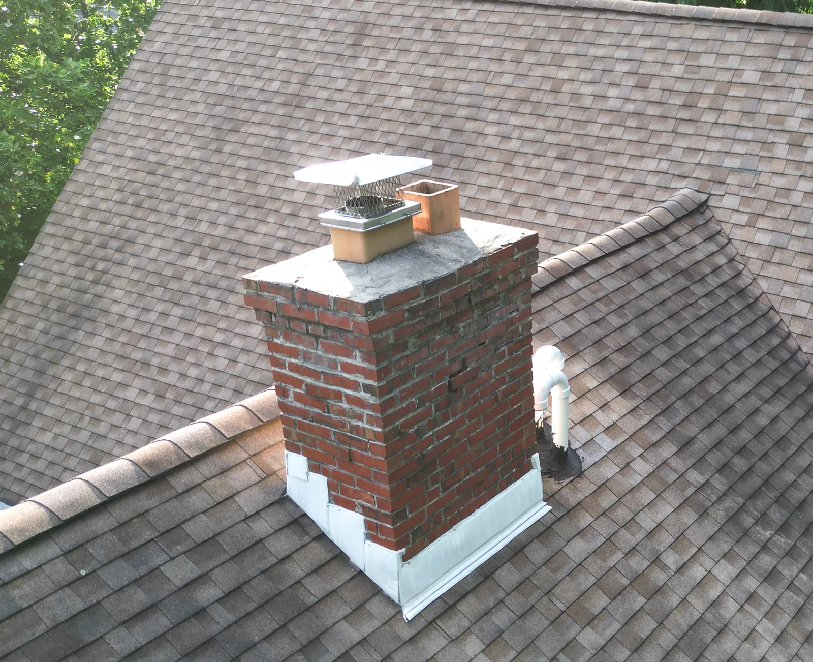
Aerial imagery for roofers, restoration contractors & property managers
Need eyes on a roof without putting anyone on a ladder? I capture high-resolution aerial imagery of roofs and building exteriors — the same documentation contractors and adjusters rely on — and deliver the full-resolution, date-stamped files within 24 hours. The imagery is yours to use in estimates, claims, and client reports.
Every slope, edge & detail
Documentation for estimates & claims
Built for multiple properties
Visual documentation only — not a licensed inspection or official report. I deliver the imagery; assessments, estimates, and reports stay with your licensed professionals.
Flat rates, travel included across Greater Philadelphia
$149
Every angle a listing needs
$249
The full listing media kit
from $199
Per property — roofers & property managers
Large properties, multi-building portfolios, recurring work, or commercial jobs? Ask for a custom quote.
From booking to your inbox in three steps
Send the address — I confirm airspace and your slot same day.
30–45 minutes at the property. You don’t need to be there.
Download link within 24 hours — MLS-ready, full resolution.
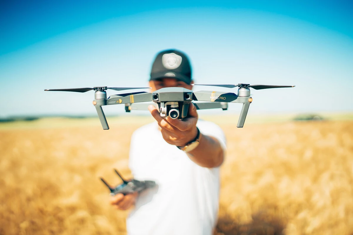
The pilot
I'm an FAA Part 107 certified, fully insured drone pilot — capturing properties for real estate agents, roofers, property managers, and local businesses from angles ground-level photography can't reach.
Every shoot is flown, edited, and delivered by me, so you work with one person from the first call to the final files.
Serving the Greater Philadelphia area.
The practical stuff, answered up front
Drones can’t fly in rain or high wind. I watch the forecast, and if conditions turn we reschedule at no charge — usually within a day or two.
Most neighborhoods, yes. Parts of the region sit in controlled airspace near the airports, where I request FAA authorization — often instant, occasionally a day of lead time. I check the airspace for every address before confirming your booking.
No. Travel is included everywhere in Greater Philadelphia, including Montgomery and Bucks counties.
Every photo in two versions: MLS-ready web-optimized files and full-resolution originals, delivered by download link. Video comes as a ready-to-post MP4, with a vertical reel for social if you booked it.
Within 24 hours of the shoot — usually the next morning.
Yes to both — FAA Part 107 certified and carrying liability insurance, flying an FAA-registered drone. If your brokerage needs a certificate of insurance, just ask.
Absolutely — it’s one of my core services. I capture high-resolution roof and exterior imagery for contractors, restoration companies, and property managers, and I’m happy to set up recurring or multi-property work with volume pricing. Certificates of insurance available on request.
Yes. I capture clear, date-stamped aerial imagery of roof and exterior damage that you can use in estimates and insurance claims. To be clear, I provide the imagery only — I’m not a licensed inspector or adjuster, so the assessment and report stay with your licensed professional.